San Antonio Hot Springs
- Free
- Roadside
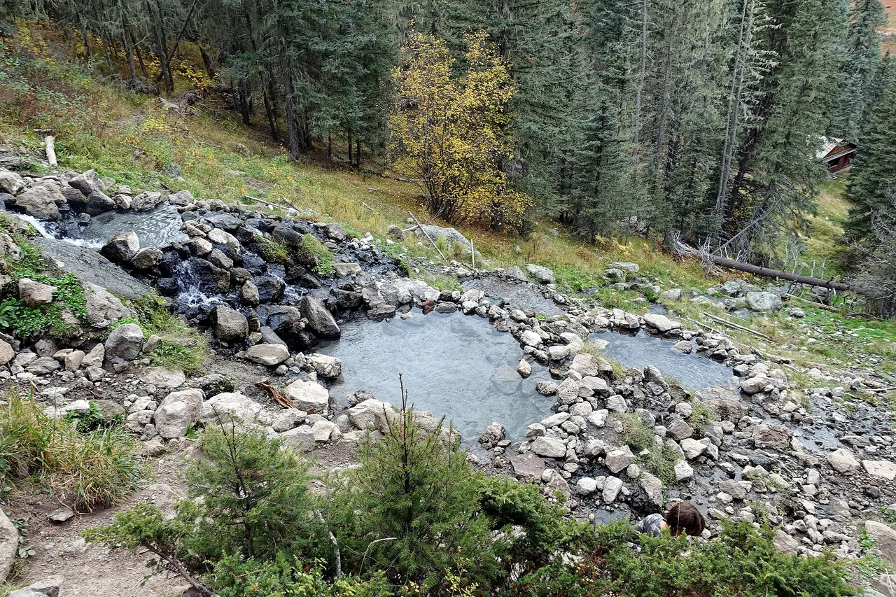
Hot water emerges from several sources on a steep hillside and flows into a series of primitive rock-lined pools of different temperatures. It is reached by a 0.7-mile out-and-back trail from a small parking area after 5 miles on Forest Road 376 (north). Check Santa Fe NF road alerts before going, as FR 376 had storm damage in late October 2026.
Oct 30, 2026: storms damaged SFNF roads; FR 376 closed at its south end and at the Gilman Tunnels. Confirm north access (505-438-5321).
- Price
- Free
- Nearest town
- La Cueva
- Hike (one way)
- Roadside
Plan your visit
Tickets & booking
| Price | Free |
|---|---|
| Access | Free public access |
On site
| Lodging | No |
|---|---|
| Land manager | USFS |
Not stated by the land manager: swimwear, ages, dogs.
Soak responsibly
- Pack out everything, including food scraps and toilet paper. Use WAG bags where required.
- No soap, shampoo or sunscreen in the pools; rinse away from the water.
- Check permits and closures with USFS before you go.
- Keep groups small and give others space. Respect posted dog and camping rules.
Water temperature
This venue doesn't publish pool temperatures.
Mineral profile
Total dissolved minerals
150 mg/L
Lightly mineralized · Sodium–sulfate (sodium sulfate water)
- pH
- 7.7
- Temp at source
- 104°F
- Lithium
- 0.04 mg/L
- Fluoride
- 0.80 mg/L
- Boron
- 0.04 mg/L
- Iron
- 0.16 mg/L
Lab analysis of the source water at “Santa Fe National Forest San Antonio Hot Springs”, sampled 1973–1974 by the USGS and partners (data). Pool water may be cooled, mixed or treated, and spring chemistry is generally stable over decades. We report measurements only; we don't make health claims.
What's here
- Santa Fe National Forest
- several rock-lined pools of different temperatures
- hillside springs
- Forest Road 376 access
Getting there
| Elevation | 8,421 ft |
|---|---|
| Road |
|
| Trail | 0.7-mile out-and-back trail per the Forest Service |
| Parking | Small parking area |
Things to do near La Cueva
Jemez Historic Site
State historic site in Jemez Springs with the ruins of Giusewa Pueblo and San Jose de los Jemez mission.
Valles Caldera National Preserve
NPS preserve around a volcanic caldera up NM 4 from Jemez Springs; hiking and wildlife viewing.
Campgrounds
- Seven Springs Camp Ground2.4 mi
- San Antonio Campground3.7 mi
- Calaveras Campground3.7 mi
- Redondo Campground5.5 mi
Trailheads
- Alamo Canyon Trailhead2.7 mi
- Banco Bonito Trailhead7.1 mi
- Valle Jaramillo Trailhead8.1 mi
- Abrigo Trailhead8.5 mi
Straight-line distances. Campground and trailhead data © OpenStreetMap contributors.
Nearby springs
Spence Hot Spring
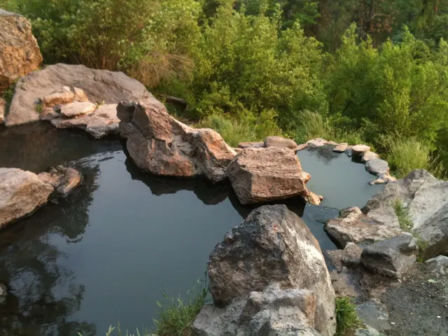
A popular warm spring on a hillside above the Jemez River, reached by a short trail from a small paved lot on NM 4 about 7 miles north of Jemez Springs. The Forest Service says the spring has cooled over the years to roughly body temperature (listed at 95°F), and its small pool holds only a few people. It is day use only, nudity is cited under state law, and glass, camping and fires are banned.
McCauley Warm Springs
Two large warm pools at about 99°F in a forest meadow between Battleship Rock and Jemez Falls, reached on East Fork Trail #137. State tourism puts the hike at about 2 miles from the Battleship Rock picnic area. The village tourism site says these public-land springs are day use only, with no camping, fires or facilities.
Jemez Hot Springs
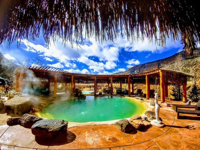
Formerly Giggling Springs, this walk-in soaking spot in the village has four outdoor mineral pools kept at 98-105°F beside the Jemez River. Soaks are sold by the hour on a first-come basis, swimsuits are required, and visitors must be 14 or older. The pools use UV light instead of chemicals and are drained and cleaned every night.
Spence Hot Spring: 6 mi · McCauley Warm Springs: 8 mi · Jemez Hot Springs: 12 mi
Sources (5)
· checked November 2026
Prices, hours and rules are checked against the official site and land-agency pages. Spot something out of date? Let us know.